Great River Energy and its member-owner cooperatives use a shared Geographic Information System (GIS) software platform, which promotes a good data sharing environment and has become a mission-critical tool for system reliability and response.
GIS is a framework for gathering, managing and analyzing data organized into layers of information and integrated into maps.
“It has become a critical part of how we make decisions around strategic aspects of our business,” said Jeff Grussing, Great River Energy’s manager of GIS development and technology, adding that GIS has improved reliability, resiliency, safety, situational awareness, project management, sustainability and planning for Great River Energy’s future.
For example, GIS provides mobile mapping for field crews, manages transmission right-of-way vegetation clearing activities and provides critical lightning strike data for operations. GIS also helps track progress on meter upgrades throughout Great River Energy’s service territory and locates field crew trucks during outages.
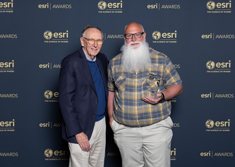
Because of its success, Great River Energy’s GIS department was the recipient of a Special Achievement in GIS (SAG) Award at Esri’s 2024 International Users Conference. The cooperative is one of 197 SAG Award winners selected from more than 100,000 clients of Esri, a global GIS software company.
Grussing accepted the award on behalf of Great River Energy during the 2024 International Users Conference, which was held in San Diego, California.
Since implementing GIS across the organization, Great River Energy has experienced significant efficiency increases.
Grussing said Great River Energy has many challenges to overcome in the electric generation and transmission industry, from rebuilding aging infrastructure to planning for new carbon-free generation resources.
Great River Energy has developed several GIS solutions to assist with its day-to-day operation, including vegetation management, infrared survey, aerial line and ground survey.
GIS is also being used to keep employees safe as critical safety information is loaded as GIS features in the system so employees can access the data anywhere they go. GIS provides value to cooperative members because it plays a pivotal role in maintaining system reliability and quick response when outages do occur.
 " data-object-fit="cover">
 " data-object-fit="cover">